Thalang Fm
Type Locality and Naming
Synonym: หมวดหินถลาง
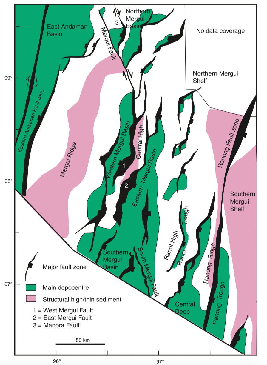
[Figure 1: Map of the Mergui Basin showing the main structural features including basin depocentres, based on an extensive grid of 2D seismic reflection data. (From C K Morley & A Racey, 2011)]
Lithology and Thickness
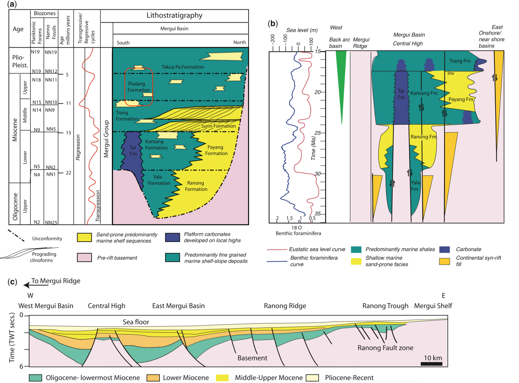
[Figure 2: Stratigraphy and cross-section through the Mergui Basin, Andaman Sea, based on data in Polachan & Racey (1994) and Andreason et al. (1997). (a) Oligocene–Recent stratigraphy of the Mergui Basin; (b) stratigraphy of the syn-rift section (Oligocene–early Miocene) schematically illustrating the east–west variation in stratigraphy across the basin and the effect of rift-basin highs (e.g. Central High horst block) on large-scale distribution of sedimentary facies, modified from Andreason et al. (1997); (c) east–west cross-section through the Mergui Basin illustrating the typical half-graben geometries of the basin (modified from Polachan & Racey 1994). (From C K Morley & A Racey, 2011)]
Relationships and Distribution
Lower contact
Upper contact
Regional extent
GeoJSON
Fossils
Age
Depositional setting
Additional Information

